Arnon River, Valley, and Gorge.
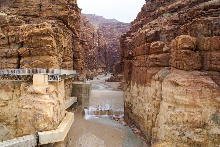
Ancient Boundary Marker for Israelites, Moabites, Ammonites and Amorites.

Arnon Gorge where it comes into the Dead Sea.

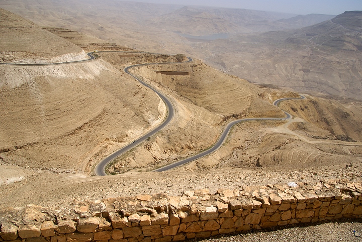
The Arnon River is mentioned a number of times in the Old Testament, primarily as a boundary marker or geographic point of reference. This river flows into the Dead Sea on its eastern side, in the modern country of Jordan. Much of its water flow has now been restrained and diverted, resulting in minimal flow into the Dead Sea (see photo above).

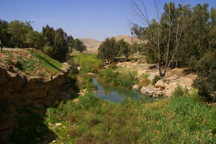
The Arnon at one of its wider spots further east near the Kings Highway

In ancient times, prior to the Exodus, it was the boundary between the Amorites to its north and the Moabites to its south. Israel subsequently took the northern territory at the end of the Exodus, though they did not always maintain later control over all this area.

Numbers 21:13-15 They [the Israelites] set out from there and camped alongside the Arnon, which is in the desert extending into Amorite territory. The Arnon is the border of Moab, between Moab and the Amorites. 14 That is why the Book of the Wars of the Lord says: ". . . Waheb in Suphah and the ravines, the Arnon 15 and the slopes of the ravines that lead to the site of Ar and lie along the border of Moab." (NIV) [More of Numbers 21 is included below, including the account of taking the territory]

The Arnon at one of its wider spots further east near the Kings Highway, a couple miles from the photo above.

The upper plateau of Moab is drained by two primary streams and their lesser tributaries. Wadi Wala (alt. Seil Hedan) to the north and Seil el-Mojib to the south both flow through amazing gorges about 2 miles (3 km) wide at the top and about 125 feet (38 meters) wide at the bottom. Though varying in depth, portions are around 2300 feet (701 meters) deep. These two gorges come together approximately 13 miles (21 km) east of the Dead Sea and are known as Wadi Mojib. The valley narrows dramatically at the Dead Sea end, which is located at about the midway point of the Sea north to south.

The depth of the gorge is one of the reasons that it became such a distinctive and recognizable boundary. Its general impassability to the west also caused the primary north-south roadway, the Kings Highway, to be located farther inland from the Dead Sea versus following the Jordan Valley.

Numbers 20:17 Please let us pass through your country. We will not go through any field or vineyard, or drink water from any well. We will travel along the king's highway and not turn to the right or to the left until we have passed through your territory." (NIV)

Wadi Mojib is sometimes referred to as the grand canyon of the Middle East. For someone who had never seen the actual ravines or gorges, the wording of the King James Version could seriously be misunderstood. For reference we have repeated the NIV scripture passage quoted above, this time from the KJV. Take note of the term "stream of the brooks":

Numbers 21:14-15 [NOTE KJV "Brooks"] Wherefore it is said in the book of the wars of the Lord, What he did in the Red sea, and in the brooks of Arnon, 15 And at the stream of the brooks that goeth down to the dwelling of Ar, and lieth upon the border of Moab. (KJV)

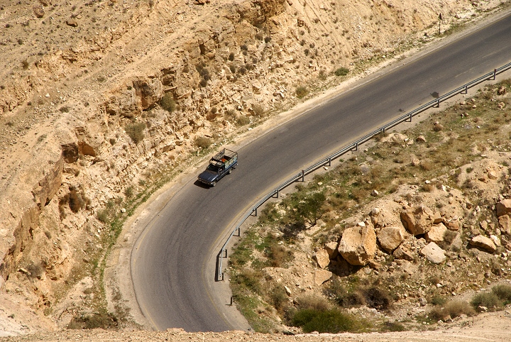
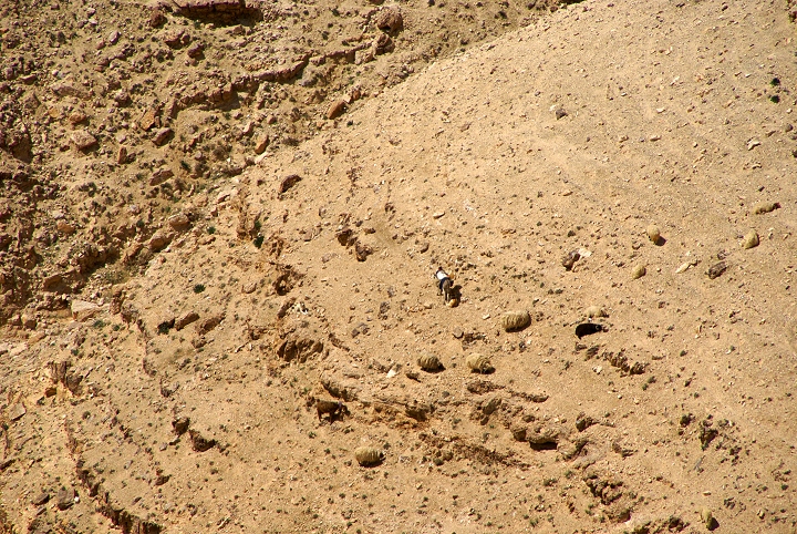
This modern road helps show how steep the sides of the Arnon valley are. Note the truck approaching the lower hair-pin turn

This is a close-up of the truck in the photo above this one


Control of both sides of the Arnon was likely militarily desirable to also dictate access to the water source. Certainly the territory around it was much disputed. King Sihon of the Amorites appears to have taken the territory on the north from the Moabites.

Numbers 21:22-29 "Let us pass through your country. We will not turn aside into any field or vineyard, or drink water from any well. We will travel along the king's highway until we have passed through your territory." 23 But Sihon would not let Israel pass through his territory. He mustered his entire army and marched out into the desert against Israel. When he reached Jahaz, he fought with Israel. 24 Israel, however, put him to the sword and took over his land from the Arnon to the Jabbok, but only as far as the Ammonites, because their border was fortified. 25 Israel captured all the cities of the Amorites and occupied them, including Heshbon and all its surrounding settlements. 26 Heshbon was the city of Sihon king of the Amorites, who had fought against the former king of Moab and had taken from him all his land as far as the Arnon.

27 That is why the poets say: "Come to Heshbon and let it be rebuilt; let Sihon's city be restored. 28 "Fire went out from Heshbon, a blaze from the city of Sihon. It consumed Ar of Moab, the citizens of Arnon's heights. 29 Woe to you, O Moab! You are destroyed, O people of Chemosh! He has given up his sons as fugitives and his daughters as captives to Sihon king of the Amorites. (NIV)

Besides the Amorites, the Ammonites also laid claim to territory north of the Arnon. From the passage above, it implies that they only controlled some of the northern bank of the Arnon, yet later claimed it all as their former territory.

Judges 11:13-23 The king of the Ammonites answered Jephthah's messengers, "When Israel came up out of Egypt, they took away my land from the Arnon to the Jabbok, all the way to the Jordan. Now give it back peaceably." 14 Jephthah sent back messengers to the Ammonite king, 15 saying:

"This is what Jephthah says: Israel did not take the land of Moab or the land of the Ammonites. 16 But when they came up out of Egypt, Israel went through the desert to the Red Sea and on to Kadesh. 17 Then Israel sent messengers to the king of Edom, saying, 'Give us permission to go through your country,' but the king of Edom would not listen. They sent also to the king of Moab, and he refused. So Israel stayed at Kadesh. 18 "Next they traveled through the desert, skirted the lands of Edom and Moab, passed along the eastern side of the country of Moab, and camped on the other side of the Arnon. They did not enter the territory of Moab, for the Arnon was its border. 19 "Then Israel sent messengers to Sihon king of the Amorites, who ruled in Heshbon, and said to him, 'Let us pass through your country to our own place.' 20 Sihon, however, did not trust Israel to pass through his territory. He mustered all his men and encamped at Jahaz and fought with Israel. 21 "Then the Lord, the God of Israel, gave Sihon and all his men into Israel's hands, and they defeated them. Israel took over all the land of the Amorites who lived in that country, 22 capturing all of it from the Arnon to the Jabbok and from the desert to the Jordan. 23 "Now since the Lord, the God of Israel, has driven the Amorites out before his people Israel, what right have you to take it over? (NIV)

During periods of weakness in Israel, Moab was able to retake control of this territory from the Israelites. The archeological find of the Moabite stone features Mesha claiming such a victory over Israel. Another passage is found in Scriptures.

2 Kings 10:32-33 In those days the Lord began to reduce the size of Israel. Hazael overpowered the Israelites throughout their territory 33 east of the Jordan in all the land of Gilead (the region of Gad, Reuben and Manasseh), from Aroer by the Arnon Gorge through Gilead to Bashan. (NIV)

Later passages speaking of God's judgment against Moab still utilize the Arnon as a symbol of this people.

Isaiah 16:1-2 Send lambs as tribute to the ruler of the land, from Sela, across the desert, to the mount of the Daughter of Zion. 2 Like fluttering birds pushed from the nest, so are the women of Moab at the fords of the Arnon. (NIV)

Jeremiah 48:20 Moab is disgraced, for she is shattered. Wail and cry out! Announce by the Arnon that Moab is destroyed. (NIV)

 
One of the steep sides of the valley. Follow the sequence below zooming in to find the shepherd, donkey & sheep.

 
Look carefully and you can see the donkey

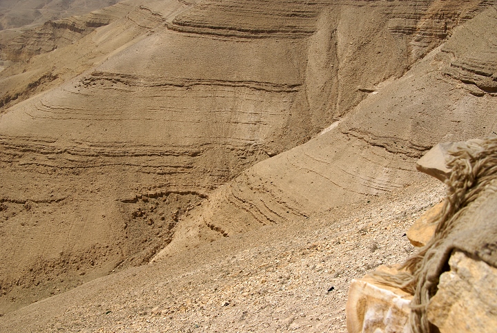
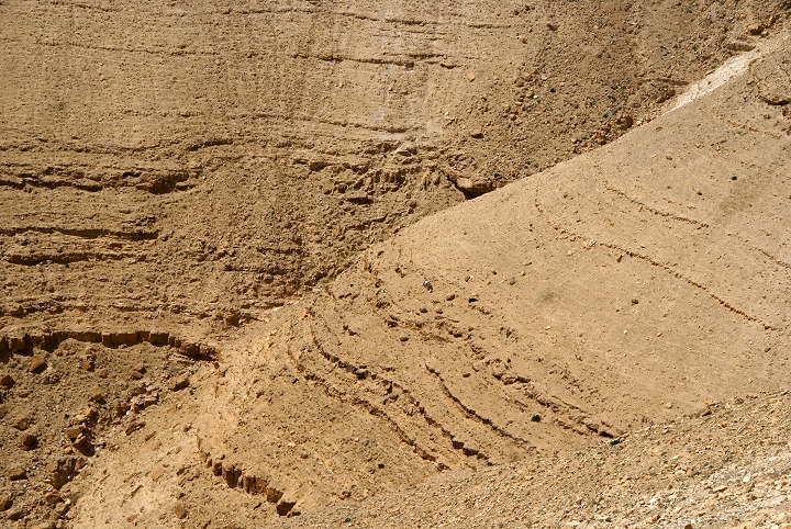
At max zoom, you can now see the donkey, sheep, shepherd, and even a goat!
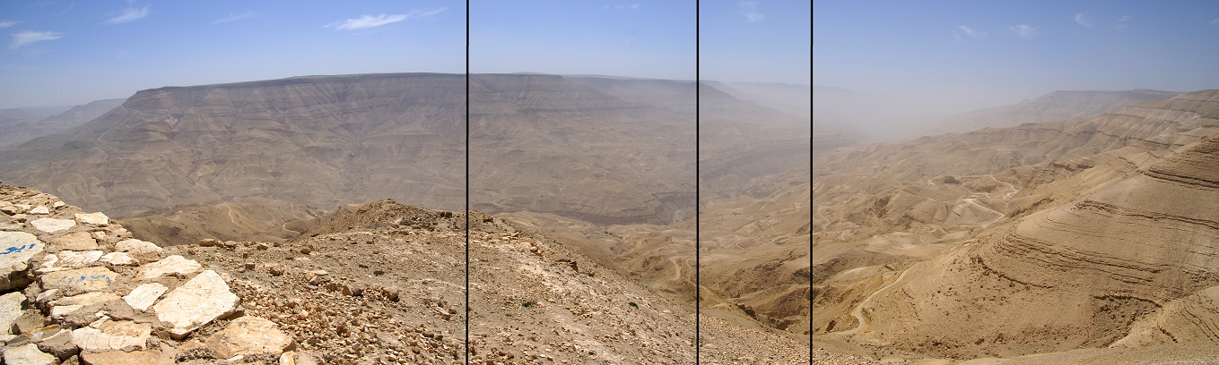
 

Arnon Valley again, note the modern dam holding back the water in the background.
See zoom-in below for perspective

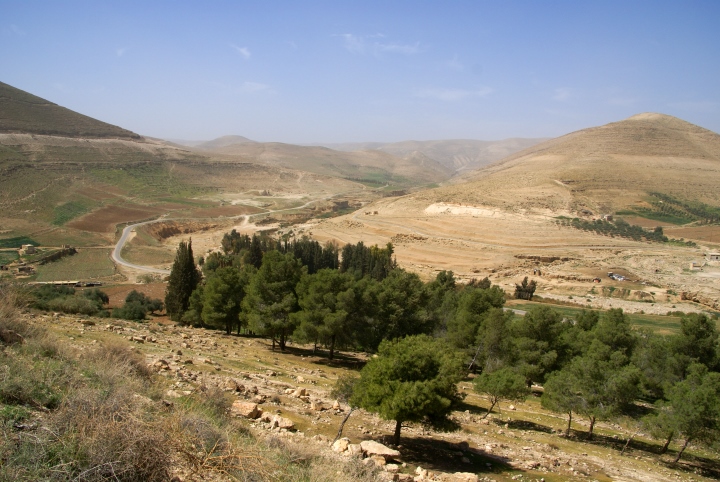
Panarama of another view of the massive Arnon Valley. Click on it to zoom in, use your browser back button to return.


(c) 2008 Brent MacDonald/LTM.