|
|
|
|
|
|
|
|
|
|
|
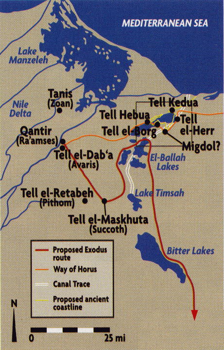
The
Land of Goshen in Egypt |
|
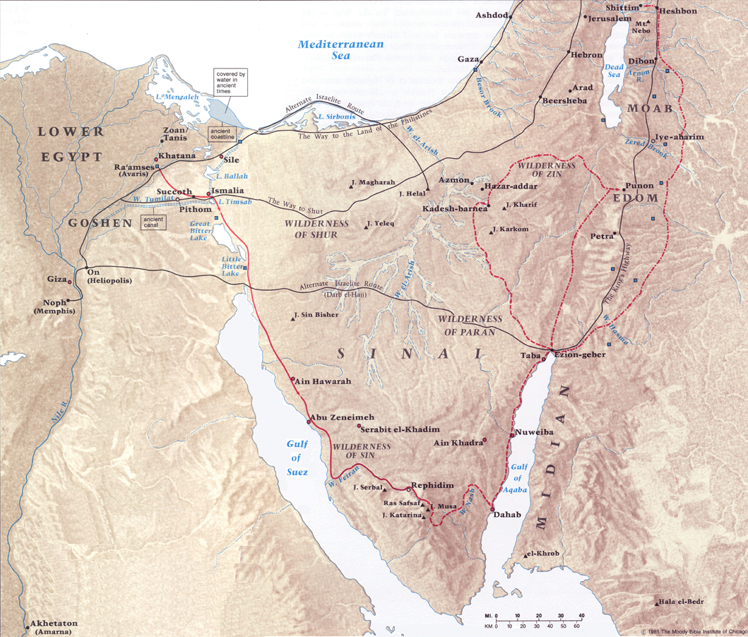
Typical
map showing alternate routes for the exodus. Part I The land of Goshen is a northeastern section of the Egyptian Nile Delta. Abraham, during his travel and stay in Egypt, would have passed through this region before heading on towards Giza and Memphis. Later, on return to Israel, when Abraham was graciously allowing Lot to choose the best of the land, it likely would have been the lush region of Goshen (and certainly the entire Nile region) that would have been fresh in their mind...
Approximately two centuries later, when Joseph had become ruler (under Pharaoh) over the land, much of the administrative power of Egypt was now concentrating in the Delta region (with the capital actually relocating there during the Hyksos period which followed). During a famine, due to irrigation, the Delta region would also suffer the least (Genesis 41:53-57). When Joseph wanted his family to move into the land, the Land of Goshen was a primary location for a number of reasons...
The final reason, listed above, has much intertwined with it. During this time in Egypt, shepherds were considered outcasts. Had Joseph's family needed to travel further into Egypt, away from their border of entry, it would have provoked reaction from the Egyptian people. All these reasons came together to enable Joseph to provide his people with some of the best land in the country (for tending livestock, versus growing crops).
It is certain that Joseph lived close to this region because he was able to be easily notified of the arrival of his family in Goshen and then travel out to meet them. The region of Goshen is only 30 to 40 miles long (maybe 900 square miles total), primarily above (north of) Wadi Tumilat and bordered by Lake Timsa and the Nile itself. One of the amazing things noted in Scriptures, during the events leading to the exodus, was that God protected this geographic region from some of the plagues which were felt throughout the rest of Egypt.
A few major cities are identified with the region of Goshen, notably Pithom and Rameses, especially in regards to the slave labor of the Israelites in the generations following Joseph. These store cities were likely built/expanded due to the memory of Joseph's earlier actions in storing provisions in the face of famine. Clearly the decendants of Jacob, themselves, were spread throughout the entire region as they were multiplied greatly during this time.
It is this reference to the city of Rameses that has led people to speculate that Pharaoh Rameses II (alt Ramses II) was the Pharoah of the Exodus. Pharaoh Rameses I is ruled out because he had an extremely short two year reign (about twenty years earlier). Church historian Eusebius of Caesarea (275-339 A.D.), who was quite accurate on many other things, appears to have been the first to speculate that Rameses II was the Pharaoh of the exodus. He was wrong. Far too much Biblical and historical evidence points to a much earlier date for the exodus, for example...
In reality, two primary possibilities exist for these references to Rameses in the text.
|
|
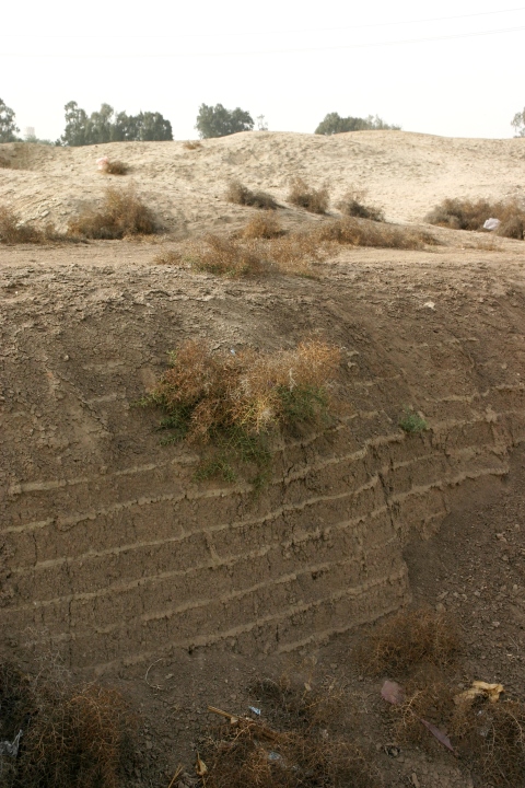
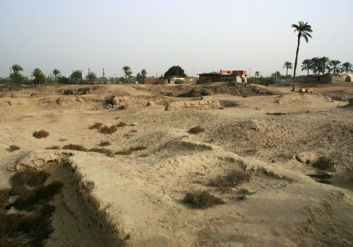
Remains of large amounts of mud bricks at Tell el-Maskhuta (Succoth)
Remains of large amounts of mud bricks at Tell el-Maskhuta (Succoth)
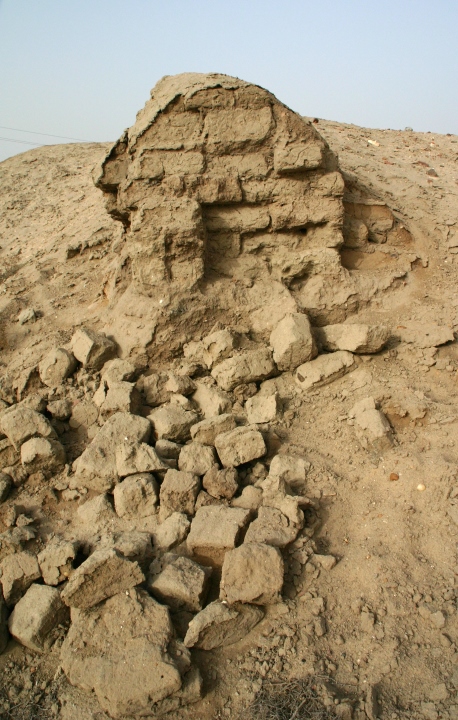
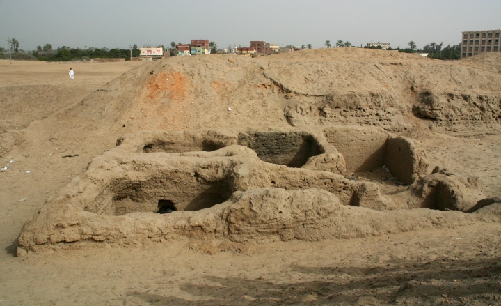
Remains
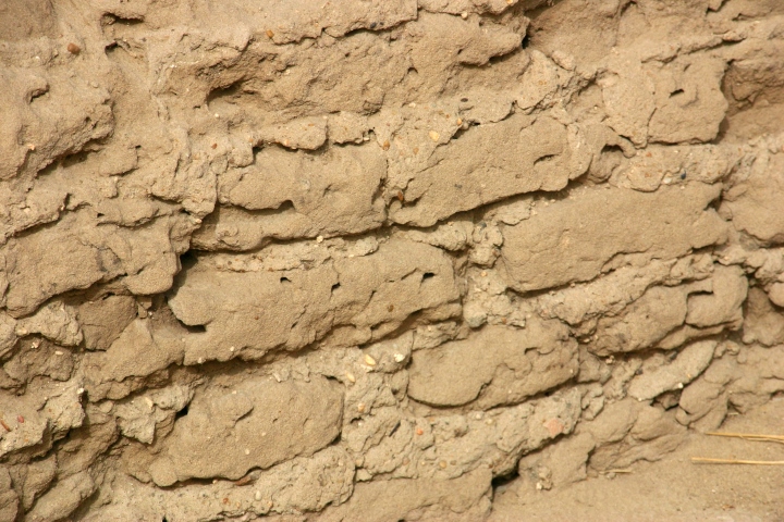
of mud bricks at Tell el Retabeh (Pithom). During Israel's enslavement in Goshen their primary occupations centered on the building projects commissioned by Pharaoh. While the strong may have been used for the actual building, even the young and weak could be utilized for making bricks. Remnants of mud bricks, made with straw, are commonly found throughout the area of Goshen.
Map
better showing the positions of Zoan, Rameses, Pithom, Avaris and Succoth
|
|
Determining the exact locations of sites in Goshen has been difficult. The Delta region is too moist to preserve papyrus documents, leaving only monuments and stone engravings. Even mud brick structures tend to deteriorate dramatically. Yet, in recent years, numerous excavations and a consensus of scholars have now identified these locations...
Following the last plague, the death of all first born, it is probable that Pharaoh was staying at Pi-Rameses when he summoned Moses and Aaron, who were likely at nearby Avaris.3 As Moses and Aaron gathered the people to leave for the exodus, their journey would have begun in the east of Goshen (namely Rameses) and ended in the west of Goshen (namely Succoth). From Succoth onward, the Israelites were truly fleeing the territory where they formerly lived.
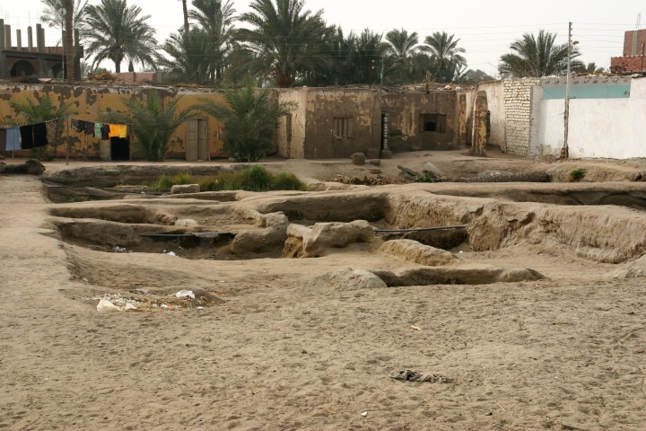
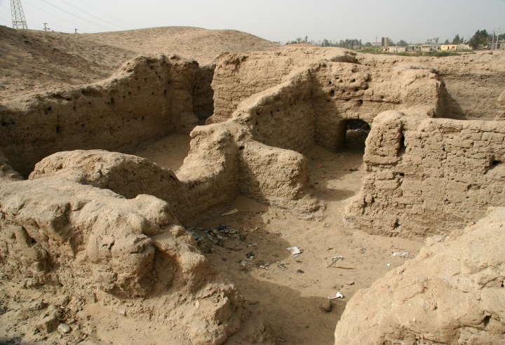
Large semitic ruins at Tell el-Maskhuta (Succoth)
Ruins of homes at Tell el-Maskhuta (Succoth). Note nearby home of modern Egyptians
Closer view of walls from homes. Exposed to the environment these will soon degrade.
|
|
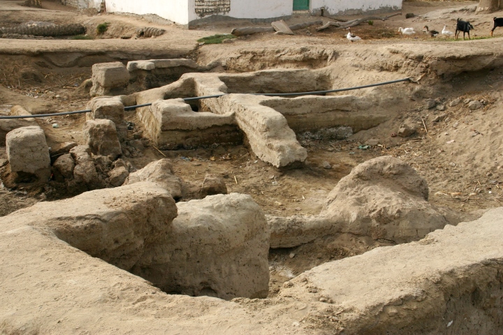
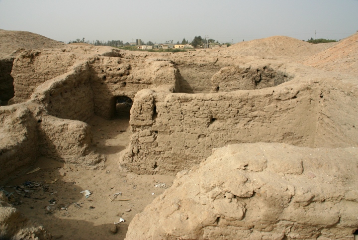
Remains
of a mud brick building at Tell el Retabeh (Pithom).
Closer view at Tell el Retabeh (Pithom).
Another view at Tell el Retabeh (Pithom).
|
|
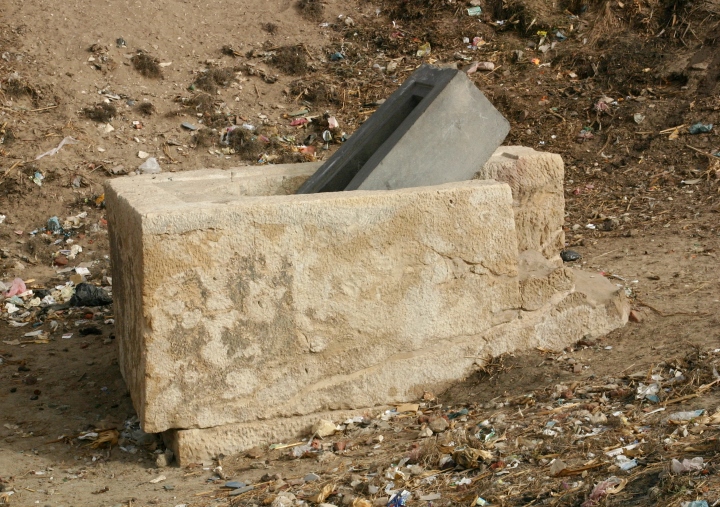
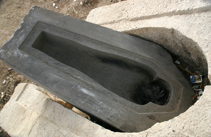
Another aspect of the Exodus had to do with Joseph. Unlike his father Jacob (Genesis 50:1-11), Joseph was unable to be immediately buried in Canaan when he died. The closing words of the book of Genesis have him demanding that his remains be taken to the Promised Land whenever the Israelites were able to return. The Bibles notes that he was embalmed, in the Egyptian fashion, and placed in a coffin in Egypt - something that would have been available to him due to his former status under Pharaoh (and perhaps as son-in-law of a prominent Egyptian priest. See Genesis 41:50).
Joseph's wish to have his body taken back to the Promised Land appears to have led them to have him interned on the eastern side of the land of Goshen. In Scriptures, the remains of Joseph are not mentioned until the Israelites have all gathered at Succoth, their last stop before the entire people were about to embark on their journey out of the country.
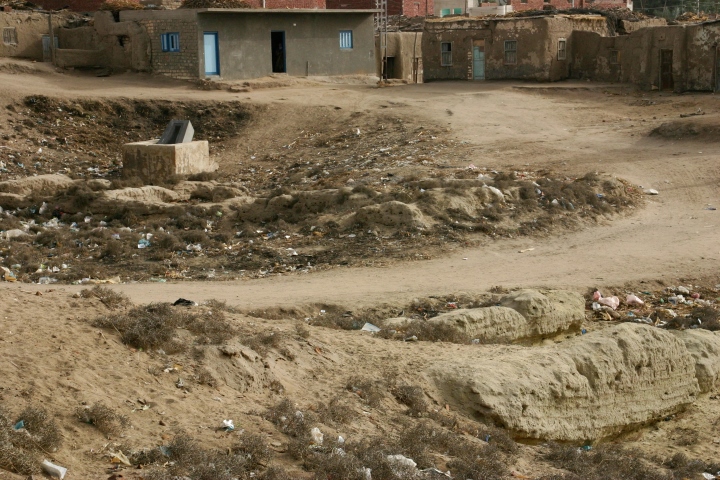
Based on these passages, it would not be out of place to discover an empty Egyptian type stone sarcophagus in the midst of an abandoned Semitic settlement at Succoth - something that has been found!
Plundered Egyptian type sarcophagus at Tell el-Maskhuta (Succoth)
Closer view. Garbage is from nearby Egyptian village
Where the embalmed body would have lain |
|
Red Sea? Reed Sea? Which Sea?
The
Holman Christian Standard Bible Map showing alternate routes of the
Exodus. Their map marks the north-south and For those who accept the Biblical account that the Israelites crossed over a sea during the Exodus, a long standing dispute arises over which Sea. Unfortunately many scholars take a low view of Scriptures, reluctantly assuming that - if the exodus actually took place - it had to be through perhaps a shallow body of water. This belief presupposes that the people waded across, or perhaps that extra dry conditions had naturally dried up some portion on the edge of a marshy area. Any supernatural involvement is summarily dismissed. This becomes virtually the sole reason that a more northerly crossing has been proposed through, or near, the relatively shallow and marshy El-Ballah Lakes. An inquiry based on the Biblical evidence all supports a search south of this region. Having a high view of Scriptures and an understanding of God's direct involvement in this entire event; there is no question that the Israelites crossed a large body of water by supernatural aid. This expanse of water not only required it being parted by God's intervention, enabling a large host of people to cross on dry ground, it had to have sufficient volume withheld to facilitate the drowning of Pharaoh's charioteers and cavalry when it was subsequently released. If God had the Israelites cross at a shallow marshy lake, as skeptics often propose, it would have been a greater miracle to have the water standing up on each side as a wall and then drowning pharaoh's entire army, as described in Scriptures. Because they don't believe in any supernatural involvement they of course dismiss that description as an exaggeration. You may be thinking, "doesn't the Bible say which Sea was crossed? Isn't it the Red Sea?" But it's not always that easy. Place names and geographic references change over time, sometimes being forgotten, and often referencing more than one location. Today we have one primary body of water called the Red Sea. It is south of the Sinai Peninsula, bounded by Saudi Arabia on the right and Egypt on the left. Two protrusions extend northward to each side of the Sinai, the Gulf of Suez to the West and the Gulf of Aqaba to the East. Historic references make mention to all three of these bodies under the Red Sea title, perhaps showing they were known to be one body of water. In ancient times it is believed that the Great and Little Bitter lakes, immediately north of the Gulf of Suez, were once naturally connected to the Gulf, in fact making them part of the Red Sea. This historic memory could alone account for continued usage of the Red Sea designation for the lakes north of the Suez. Without a direct connection, the Red Sea may merely be a general term. Herodotus, a Greek Historian, who lived circa 484-425 B.C. (writing circa 440 B.C.), utilized the Greek term for the Red Sea to encompass not only the Gulf of Suez, the Gulf of Aqaba, and the present Red Sea, but also the Indian Ocean! By his usage it was obviously quite a generic name for the large bodies of water south of the Mediterranean or Great Sea. End Note 6 This broad usage of the Hebrew term translated "Red Sea" is also seen in the much earlier Biblical text. Consider when the plague of locusts descended on the land of Egypt - the entire land of Egypt - their removal was effected by a wind out of the west that took them towards the east of the land. This simply said that the wind blew them out of Egypt towards all the large bodies of water to the east, including the Red Sea proper, the Gulf of Suez, the Bitter Lakes, and Lake Timsah. If only the most southerly body was in view, for much of Egypt, especially the land of Goshen where the primary story is set, it would have required a wind blowing more towards the south instead of towards the east.
By the time the Old Testament was being translated into Greek, circa 283 B.C., the translators still followed this general usage of the Greek title "Red Sea" to reference the large body of water being crossed during the Exodus. From the Greek Septuagint translation, often quoted by the apostles, we get the same wording in the New Testament: Acts 7:36 and Hebrews 11:29. These citations are not given in an attempt to better define where the Israelites crossed, they are merely references back to the historic event in the Old Testament, assuming (and divinely confirming) that the translators used a term that properly encompassed a body of water that could be called by that name. This returns us to the Old Testament passages for a better understanding of what specific body of water is in view. Many Bible translations now routinely footnote the term "Red Sea" to say "Sea of Reeds". For those having a low view of Scriptures, they gleefully point to this and say that it's proof that it was just some marshy area that was crossed. But again, Scriptures make it clear that it was a large body of water with sufficient depth to subsequently drown an army. So the question remains, where does this "Sea of Reeds" come from and is it accurate?
Click
here for a later detailed follow-up article on the meaning of Yam Suph Word meaning has much to do with identifying places names in ancient times. This has led scholars to try and determine the origin of the Hebrew words subsequently translated as "Red Sea". The Hebrew words, transliterated into English, are "Yam Suph," typically directly translated as "Sea of Reeds". References within Egyptian papyrus, from this early period, seem to give credibility to this possibility as similar wording refers to the "Land of Marshes" - as such, the Land of Reeds. Indeed, an Egyptian word for papyrus, itself a water reed, is similar to the Hebrew "suph." Part of the problem with applying the broader Egyptian references to the Hebrew, regarding the places of reeds, is that all locations mentioned in the papyrus are designated lands or regions rather than bodies of water, as is our Hebrew reference. The Egyptian references typically refer to any of the north east delta which again leaves us with a non-specific area. The Hebrew word "Sea" doesn't have to mean the vast bodies of water we typically refer to as seas, ancient usage could apply this equally to lakes (even as the Sea of Galilee and the Salt Sea, are inland lakes within Israel). If the usage of "Yam Suph" is "Sea of Reeds", meaning reeds that grow in fresh or brackish water, this would rule out salt water bodies such as the Gulfs of Suez and Aqaba as well as the Red Sea proper. Contrary to the revisionist skeptics, this does not have to mean shallow except along the shores where the reeds grow. It mostly would imply having more fresh water than the Red Sea in which to grow the reeds. Context helps establish the word "Suph" - the best context coming from the specific book where "Yam Suph" is first being spoken about. Earlier, in the account of the baby Moses being saved after being hidden in a basket in the Nile River, the basket is said to have been hidden among the "suph (reeds)." Here fresh water reeds are clearly in view.
The alternate view, that still tries to place the crossing much further south, at the Gulf of Aqaba, needs "suph" to be in reference to "seaweed." It is true that "suph" can be in reference to both fresh water plants and salt water plants, at least in later usage. The best biblical example comes from a usage, in the account of Jonah, dating hundreds of years later.
The "seaweed" that was surrounding Jonah in the Mediterranean Sea was "suph." This broad possible usage of the term "suph" likely helped to create the widespread usage of the term "Red Sea". It certainly wasn't the blue green color of the waters. As stated before, it was a generic term for large bodies of water south of the Mediterranean Sea (that had its own more specific name). End Note 6 Since the more immediate context places "suph" in association with fresh water reeds, I still hold that it is more probable that the body of water was closer to Goshen, namely one of the large inland lakes. The question next needing consideration is why would the Israelites be boxed in by a body of water? Indeed, if it was the northern part of the Gulf of Suez, why didn't the Israelites cross over into Sinai at a host of locations north of that point between the lakes? If it is one of the lakes, why couldn't the Israelites not merely move around it and into the Sinai? The answer appears to have been found in archaeology.
When the Israelites first left Succoth, in the Delta, they turned north. Logically it would have been the fastest way out of Egypt to the Promised Land, going by the northern road. God did not want them to go by this road as it would have taken them through Philistine territory and most assuredly led to war (Exodus 13:17). Instead, they would have needed to head almost due east into the Sinai ("on the edge of the desert"). God's instruction to turn back, now took them south "hemmed in by the dessert". Quite specifically they were hemmed in by the ancient canal extending northward from Lake Timsah to the Mediterranean. This could not be crossed at any spot except for the main trade routes, such as the one God had prohibited them from taking to the north. This north-south canal was not small either.2 While its' 10 foot maximum depth doesn't sound that deep, compound that by a 200 foot width and you have a formidable barrier. Add periodic fortresses along its expanse and you have an effective and defendable border. Those who have made the fanciful claim that Mt. Sinai is actually across the Gulf of Aqaba in Saudi Arabia often make the claim that Egypt's borders extended to the Gulf of Aqaba. They then state that Israel would have had to gone beyond this to be out of Pharaoh's reach. What they have missed is that while the Pharaoh's of Egypt professed to control Sinai, and certainly had commercial interest there; it was never considered to part of Egypt. The true border of Egypt ran from the Mediterranean to the Red Sea, along the canal system and barrier lakes west of the Sinai wilderness. A question that has not been effectively answered thus far is whether or not the canal system also ran south of Lake Timsah to the Bitter Lakes, as the modern Suez Canal does now. Perhaps subsequent archaeological finds will definitively confirm this. At this point it's quite certain that Israel would have had to go at least as far south as Lake Timsah. If the canal extended further south, the same could be said of the Bitter Lakes, except another archaeological detail makes it less probable that they went south of Lake Timsah. There was likewise a canal on the southern side of Goshen, extending from Lake Timsah to a branch of the Nile River. While there is less indication that it was fortified to the degree of the north-south border canal, this east-west canal certainly would have been a physical barrier to the south.5
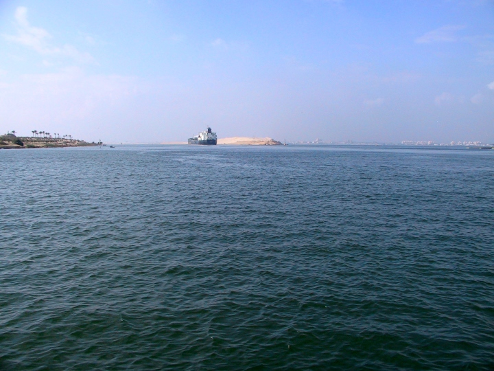
Lake Timsah where the Suez Canal enters it With their southward movement inside the eastern canal system, Moses and the people would have ended up cornered against Lake Timsah. Literally, it was the southeastern corner of the north-south and east-west canal system. There they camped by the sea, one that certainly could be called a "Sea of Reeds" with its fresh water content, but likewise as a generic large body of water south of the Mediterranean. This lake being parted would have created the walls of water and the necessary volume to drown an entire army. The Israelites, having intentionally cornered themselves at this spot, would have certainly made Pharaoh think they were confused (i.e. Exodus 14:3). Remember, it was God who chose where they were to camp, for His purposes, and for His glory! One cannot be dogmatic about Lake Timsah being the crossing point though. The Great Bitter Lake, further south, is another possibility, and even the northern most part of the Gulf of Suez, though far less likely, is at least a possibility. To get to either of these locations, the Israelites would have had to cross the east-west canal system south of Timsah. One interesting find, which perhaps supports the Bitter Lake possibility, is listed in ISBE...
Though the aforementioned letter doesn't give us specific locations for the Biblically referenced sites, it does keep them in the Lake Timsah and Bitter Lakes region.4 This would certainly eliminate a Gulf of Suez crossing and some of the more fanciful propositions, such as the one we reference next. Of all the proposed crossing sites for the Red Sea, the view that places Mt. Sinai in Saudi Arabia is the least likely. Many factors including how steep the underwater basin is, needed travel times and distances in comparison to those specified or alluded to in Scriptures, not to mention the questionable evidence offered in support of their Mt. Sinai, all make this highly improbable. Natural geological structures, such as a mountain with a blackened top, are quite common to the entire region of Sinai, Saudi Arabia, and even Jordan. Other referenced archaeological finds are undoubtedly Nabatean, having nothing to do with the time of Exodus.
The author's son, Scott, reading Scriptures at Lake Timsah
|
|
Article
by Brent MacDonald, (c) 1999-2018
End Notes: (1) Many maps of the Exodus incorrectly move the land of Goshen south of Wadi Tumilat (alt. Wady-'t-Tumeylat) to try and account for travel times between Goshen and Memphis, presupposing that Pharaoh had to be there (at the capital of all Egypt). History has revealed that this was not the case, with a northern or secondary capital being quite common. In fact, because of this Memphis error, some of the alternately proposed routes of the exodus don't even take the Israelites through Succoth. (2) A Time Magazine article entitled "The First Suez Canal?", dating Monday, October 20th, 1975, provides details concerning the ancient north-south canal from the Mediterranean to Lake Timsah.
Part of Ismalia seen from across Lake Timsah
|
|
(3) Some site lack of evidence for Rameses as a major city at this early time, though it certainly was being built as a store city according to Scriptures. An alternate view would have Pharaoh at Tanis (Zoan), and Moses and Aaron perhaps at Rameses (or nearby Avaris). This would still make it a 9-12 mile distance, one way, for Pharaoh to summon Moses and Aaron, a workable scenario if travel was by horse and/or chariot. Again, the west to east gathering of the Exodus would still be in view. The Psalmist, writing years later, references the region of Zoan as having experienced the miracles (plagues). While this provides the possibility that Pharaoh was at Zoan (Tanis), it may only by a general descriptor encompassing the region (even as the district of Rameses encompassed a vast area as well).
(4) The TourEgypt website references the same early papyrus, placing it perhaps earlier by a decade or two than the ISBE dating...
While Israel's exodus was a couple hundred years earlier, place names likely would have remainded the same for a few centuries. Maybe local legend still told the story of how an entire nation of slaves escaped via this route, leading these later slaves to try the same. (5) Planetware.com makes note of the east-west canal, stating that archaelogy shows it was wider and deeper than the north-south canal.
(6) For those who find it hard to believe that people can use a generic term to reference diverse bodies of water, consider an Egyptian practice that has continued into relatively modern times. Egyptian author Galal Amin, in the first of his books highlighting changes in Egyptian society from the 1950s until the present, notes a practice that was still commonplace in the mid 20th century.
If usage of generic terms could extend into the modern era, primarily due to "lack of any direct experience" and general "ignorance" how much more would the same reason apply to those of ancient times who would never leave their dwelling places along the branches of the Nile and its related canals in the land of Goshen? With Israel having lived in Egypt for four hundred years, mostly restricted only to their delta villages and region, it is reasonable to assume that common local practice and nomenclature of the day would be utilized by them as well. |


